Mostrar el registro sencillo del ítem
“Mapping the Spatiotemporal Distribution of Bovine Rabies in Colombia, 2005–2019“
| dc.contributor.author | Bonilla-Aldana, D. Katterine | es_ES |
| dc.contributor.author | Jimenez-Diaz, S. Daniela | es_ES |
| dc.contributor.author | Barboza, Joshuan J. | es_ES |
| dc.contributor.author | Rodriguez-Morales, Alfonso J. | es_ES |
| dc.date.accessioned | 2023-03-06T20:10:43Z | |
| dc.date.available | 2023-03-06T20:10:43Z | |
| dc.date.issued | 2022-11-29 | |
| dc.identifier.uri | https://hdl.handle.net/20.500.13053/7957 | |
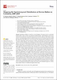
| dc.description.abstract | “: Introduction: Rabies is caused by a virus belonging to the genus Lyssavirus and family Rhabdoviridae, which can infect any mammal including humans. Hematophagous, fructivorous, and insectivorous bats have become the main reservoir of sylvatic rabies in Latin America. In the sylvatic cycle, hematophagous bats are usually the main reservoir. In contrast, dogs and cats fulfil this critical role in the urban cycle. However, in rural areas, the most affected animals are bovines. They show clinical signs such as behavioural changes, hypersalivation, muscle tremors, spasms caused by extensive damage to the central nervous system, and death from respiratory paralysis. Objective: To describe the spatiotemporal distribution of bovine rabies in Colombia from 2005 to 2019. Methods: Retrospective cross-sectional descriptive observational study, based on the monthly reports of the Colombian Agricultural Institute (ICA) on the surveillance of bovine rabies in Colombia from 2005 to 2019, retrieved from its official website. The data were converted to databases in Microsoft Access 365®. Multiple epidemiological maps were developed with the GIS software Kosmo RC1® 3.0 coupled to the shape files (.shp) of all the country’s municipalities. Results: During the study period, 4888 cases of rabies were confirmed in cattle, ranging from a peak of 542 cases (11.1%) in 2014 to 43 in 2019 (0.88%). From 2014 to 2019, there has been a significant reduction in the annual national number of cases (r2 = 0.9509, p < 0.05). In 2019, 32.6% of the cases occurred in January, and 48.8% occurred in the department of Sucre. In 2009, the maximum number of spatial clusters (13) occurred in the Orinoquia region, where other clusters were also identified in 2005, 2006 and 2008. In 2018, 98 outbreaks were identified that led to the death of cattle and other animals, 28.6% of them in the department of Sucre. In the first half of 2019, of 38 outbreaks, 55.2% were identified in Sucre. Conclusions: It is necessary to review the current national program for the prevention and control of rabies in cattle, incorporating concepts from the ecology of bats, as well as the prediction of contagion waves of geographical and temporal spread in the context of the OneHealth Approach. Sylvatic rabies remains a threat in Colombia that requires further study. “ | es_ES |
| dc.format | application/pdf | es_ES |
| dc.language.iso | eng | es_ES |
| dc.publisher | MDPI | es_ES |
| dc.rights | info:eu-repo/semantics/openAccess | es_ES |
| dc.rights.uri | https://creativecommons.org/licenses/by/4.0/ | es_ES |
| dc.subject | bovines; Lyssavirus; bats; rabies; public health | es_ES |
| dc.title | “Mapping the Spatiotemporal Distribution of Bovine Rabies in Colombia, 2005–2019“ | es_ES |
| dc.type | info:eu-repo/semantics/article | es_ES |
| dc.identifier.doi | "https://doi.org/ 10.3390/tropicalmed7120406" | es_ES |
| dc.type.version | info:eu-repo/semantics/publishedVersion | es_ES |
| dc.publisher.country | CH | es_ES |
| dc.subject.ocde | http://purl.org/pe-repo/ocde/ford#3.03.00 | es_ES |
Ficheros en el ítem
Este ítem aparece en la(s) siguiente(s) colección(es)
-
SCOPUS [380]


